| |
|
Latest update 1st February 2020
Distance tables are ideal for web services relating customer query to find nearest postcode or suburb and is the basis for such search applications such as "find my nearest..."
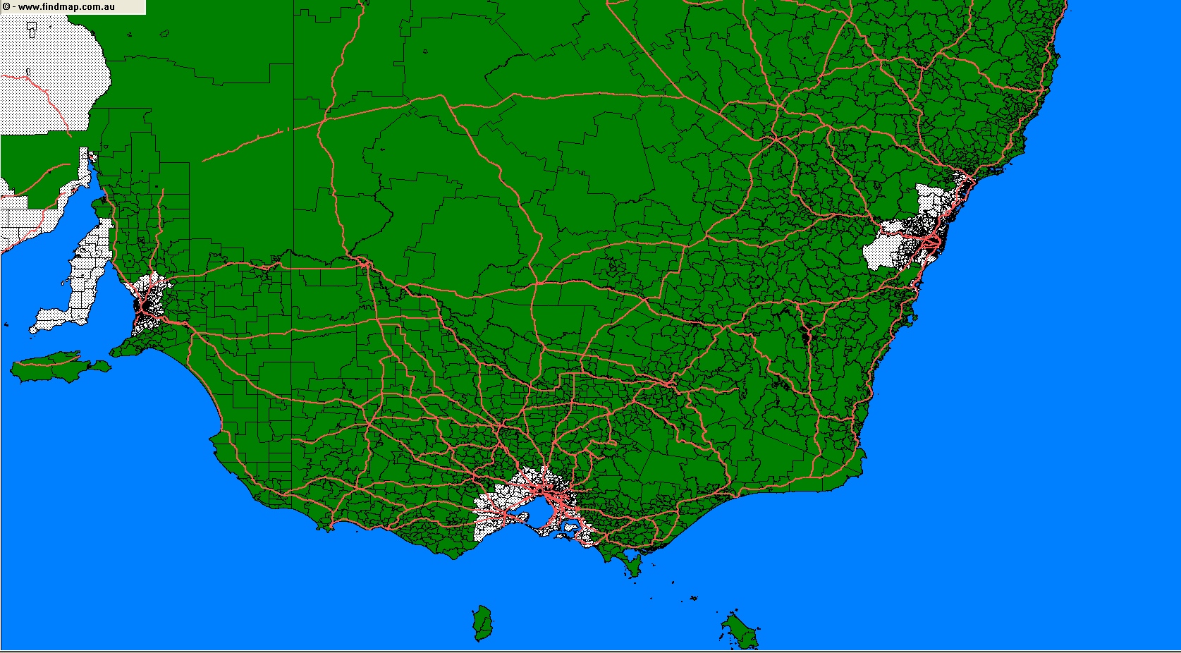
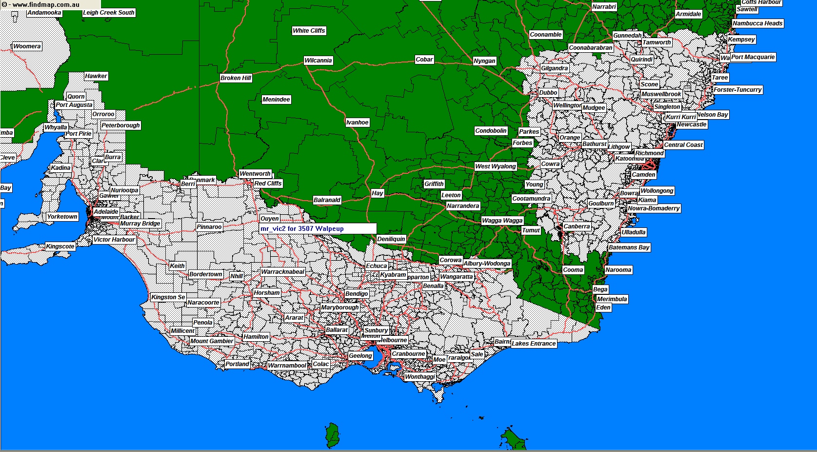
October 2018 - The By-Road Distance Table has undergone a massive upgrade in coverage from major metro and surrounds to major metro and 300+ kms in extent.
The example map shows NSW and VIC as an example of the increase.
OLD COVERAGE |
NEWLY INCREASED COVERAGE |
 |
 |
The distance table is offered with 2 levels of accuracy:
Postcodes are the best choice for the simplest use entry to accept and validate and is also the smallest distance table to load and suits most applications where a reasonable number of possible search results is likely.
Suburbs are the best choice for high levels of accuracy where fine tuning of distance, eg 2 kms, 5kms, .. is desired since the individual suburbs are used, instead of whole-of-postcode, give good results in both metro and regional situations and where large numbers of potential results may occur (eg real estate).
Each table is then offered with 2 levels of distance measurement:
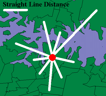
This is the simplest method of distance comparison, and typical of basic point-to-point coordinate based applications but expressed in a table format for simple database lookup.
This version is suitable for budget applications and where a basic search results sorting is sufficient or where the number of likely results is relatively low.
-
By Road (when in major metro area, is straight line elsewhere)
When the locations are within a major metro area (eg Sydney, Melbourne, Brisbane..) the shortest major road distance is calculated to give a true distance value compared to the simple straight line case.
This version is suitable for when high quality search results are required.
To recap the 4 different possibilities:
POSTCODE VERSION - Latest update - 1st February 2020
Australia's best postcode distance search product just got better with new suburb names list, postcode type and major region table and compass direction now included!
- 3,000+ Unique postcodes
- 9 Million records
- 16,500+ postcode and suburb names
- 178 Mb as .CSV file, 39 Mb as .ZIP
New Zealand version
- 1,800+ Unique postcodes
- 3.5 Million records
- 1,000+ postcode and suburb names
- 68 Mb as .CSV file, 14 Mb as .ZIP
The table containing all the postcode distance records is created by calculating the distance of every postcode to every other postcode. There are 2 versions of the Postcode Distance Table...
1. PCDIST - Postcode Distance Table - Straight Line
Available in both Australian and New Zealand editions.
Uses straight line distances from postcode centre to postcode centre. The straight line version is ideal for tight budget applications where basic sorting is the main criteria.
2. PCDISTMR - Postcode Distance Table - Metro By Road
Available in both Australian and New Zealand editions.
 Uses distances by major road from postcode centre to postcode centre where both postcodes are within major metro area and uses straight line distance elsewhere. Uses distances by major road from postcode centre to postcode centre where both postcodes are within major metro area and uses straight line distance elsewhere.
The by-road distance version is ideal for more demanding situations where accurately selecting only those locations within true travel distance of the search location is required.
The by-road version takes into account all and multiple harbour and bay crossings and other transport restrictions that exist between any 2 locations.
The product comprises a set of records ideal for direct use in a database system - no complicated 3rd party software licences or costs - you use your own familiar and compatible tools.
Data Table Format & Samples
A sample of the table record contents are as below. The postcode pair is unique with the distance between them in the 3rd column. All distances are in whole kilometres between the centre of each postcode.
The format of the records is identical for either version, it is just the distance column that differs in actual value.
Format: 5 columns in CSV format with header record and columns as follows: FromPC, ToPC, DistKms, DirFromTo, DirToFrom
Example:
FromPC,ToPC,DistKms,DirFromTo,DirToFrom
2007,2039,4,NW,SE
2007,2040,5,W,E
2007,2041,5,N,S
2007,2042,5,SW,NE
2007,2043,4,SW,NE
Where:
FromPC - From Postcode
ToPC - To Postcode
DistKM - distance in whole KMS between From-To
DirFromTo - compass direction From->To: N,S,E,W,NE,SE,SW,NW
DirToFrom - opposite compass direction To->From
All special postcodes, such as GPO Boxes and others, are included so every valid Australian and New Zealand Postcode exists in the table to cover every circumstance.
Australian sample tables
A sample of records is available in .CSV format for free download and testing.
New Zealand sample tables
A sample of records is available in .CSV format for free download and testing.
SUBURB VERSION - Latest update - 1st February 2020
Australia's best detailed suburb distance search product just got better with new suburb names list, postcode type and major region table and compass direction now included!
- 15,800+ Unique suburb and postcode pairs
- 125+ Million records
- 2.5 Gb as .CSV file, 528 Mb as .ZIP
. SUBDIST - Suburb Distance Table - Straight Line
Uses straight line distances from suburb centre to suburb centre. The straight line version is ideal for tight budget applications where basic sorting is the main criteria.
2. SUBDISTMR - Suburb Distance Table - Metro By Road
Uses distances by major road from suburb centre to suburb centre where both suburb are within major metro area and uses straight line distance elsewhere.
The by-road distance version is ideal for more demanding situations where accurately selecting only those locations within true travel distance of the search location is required.
The by-road version takes into account all and multiple harbour and bay crossings and other transport restrictions that exist between any 2 locations.
Data Table Format & Samples
File 1 of 2: Name postcode and suburb name lookup table
Format: 8 columns in CSV format with header record and columns as follows: Index,Postcode,Suburb,Comment,State,MajorRegion,IsPostal,IsUrban
Where:
Index - Allocated ID to perform lookup in the separate Distance Table
PC - is 4 digit Australian postcode
Suburb - is suburb or locality name
Comment - any notes as applicable
State - State abbreviation
MajorRegion - Major Region within State
IsPostal (Y or N) - if this location is purely postal only without any physical map boundary
IsUrban (Y or N) - if this location has a map boundary, or is postal but may be considered as a suburb for most practical applications
For example:
Index,PC,Suburb,Comment,State,MajorRegion,IsPostal,IsUrban
0,1340,Kings Cross,PO Boxes,NSW,Sydney,Y,Y
1,2000,Barangaroo,,NSW,Sydney,N,Y
2,2000,Dawes Point,,NSW,Sydney,N,Y
3,2000,Haymarket,,NSW,Sydney,N,Y
4,2000,Millers Point,,NSW,Sydney,N,Y
File 2 of 2: Distance lookup table (Index format)
Format: 4 columns in CSV format with header record and columns as follows: FromIndex,ToIndex,DistKms,DirFromTo,DirToFrom
Where:
FromIndex - lookup index into the name table for the FROM Postcode+Suburb
ToIndex - lookup index into the name table for the TO Postcode+Suburb
DistKM - distance in whole KMS between From-To
DirFromTo - compass direction From->To: N,S,E,W,NE,SE,SW,NW
DirToFrom - opposite compass direction To->From
For example:
FromIndex,ToIndex,DistKM,DirFromTo,DirToFrom
109,133,13,SW,NE
109,134,13,SW,NE
109,135,13,SW,NE
110,111,4,SE,NW
110,112,3,E,W
Sample Tables
A sample of records is available in .CSV format for free download and testing!
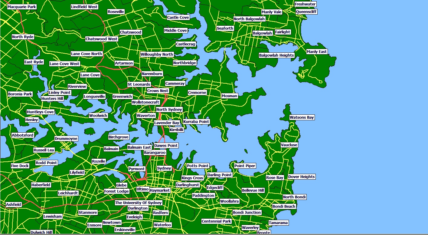
Map of coverage area for Sydney samples
|
|